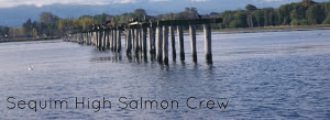
Saturday, November 30, 2013
An Educational Trip to Meadowbrook creek
Sequim High School students and employees of the North Olympic Salmon Coalition took a trip to Morse Creek this previous October! The students are taking a Natural Resources class, basing their class projects off of volunteering with NOSC. We drove the "Moby Dick," a suburban used by NOSC, to the partially muddy creek. Reed Aubin, the group coordinator and teacher, took the students on a trail to examine engineered log jams, salmon, and the general ecosystem of Morse Creek. Essentially, they received their first glance of what the class would be like. The students saw big tree logs layered into the ground, on the sides of the creek, in a particular formation. These are the engineered log jams (ELJ), and they direct a flow of water, preventing overflow or path displacement of the creek. ELJs also re-establish habitat essential to young salmon to feed, rest and escape predators. They also help the river retain smaller sized gravel in a correct assortment for the survival of salmon eggs. Another thing the class observed at Morse Creek was large woody debris (LWD), and small woody debris (SWD). LWD and SWD are essential in water ecosystems, for their decomposition results in the distribution of nutrients and chemicals that are beneficial for the plant and animal organisms that take habitat there. At the end of the day, the class left with a better understanding of one of many successful projects done by NOSC, and a look at the future of their class.
Want to see what an ELJ looks like? Check out the link below!
Engineered Log Jam
This is Morse Creek!
https://maps.google.com/maps?q=Morse+Creek,+Port+Angeles+East,+WA&hl=en&ll=48.112188,-123.34445&spn=0.019026,0.052314&sll=48.073491,-123.105927&sspn=0.609288,1.674042&oq=Morse+creek,+port+&t=h&hnear=Morse+Creek&z=15
Saturday, November 2, 2013
Pictures of 3 Crabs Prior to Restoration
 |
| Dungeness shoreline, houses, farmland, and the Dungeness River. The protruding beach you see on the lower right of the picture, is a result of longshore drift from sediment eroding from bluffs at Port Williams. |
 |
| Meadowbrook Creek is the stream to the left; it meets Dungeness Bay. At the mouth of Meadowbrook Creek, the freshwater from Meadowbrook mixes with the Dungeness Bay creating blurry-looking brackish water. |
 |
Meadowbrook Creek is the stream you see by the road that leads to the line of houses.
|
Subscribe to:
Posts (Atom)